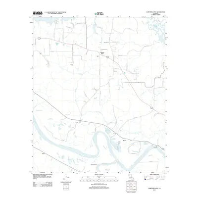
2012 Map of Fairview Alpha
USGS Topo · Published 2012About this map
The meandering Red River defines the southern landscape of this Natchitoches Parish region, creating a complex hydrology of bayous, lakes, and islands. Small rural settlements like Fairview Alpha and Grappes Bluff anchor a network of parish roads, while the presence of the Alpha Gas Field and Powhatan Gas Field highlights the local importance of the energy industry. The map reveals the intricate drainage patterns of the Red River Valley, including The Coulee, Sims Bayou, and The Crevasse, which shape the fertile land between the river and Black Lake. For genealogists and local historians, several family-named landmarks and cemeteries provide important clues to the area’s heritage. The distribution of sites like Bethany Cem, Hawes Cem, and Zion Cem alongside Smith Island illustrates the long-standing relationship between these riverside communities and the shifting water levels of the floodplain.
Find a feature on this map
66 named features on this map. Tap any name to fly to it.
Don’t see what you’re looking for? This feature index may not catch every label — zoom into the map to look around manually.
Map Details
Editions of this 2012 Fairview Alpha Map
This is the sole edition of this map. No revisions or reprints were ever made.
Other maps of this area

1937 · Campti NE
USGS Topo · 1:31,680

1937 · Campti SE
USGS Topo · 1:31,680

1937 · Campti NW
USGS Topo · 1:31,680

1937 · Campti SW
USGS Topo · 1:31,680

1938 · Allen
USGS Topo · 1:31,680

1938 · Lake End
USGS Topo · 1:31,680

1944 · Campti
USGS Topo · 1:62,500

1947 · Ashland
USGS Topo · 1:62,500

1947 · Hanna
USGS Topo · 1:62,500

1948 · Coushatta
USGS Topo · 1:62,500