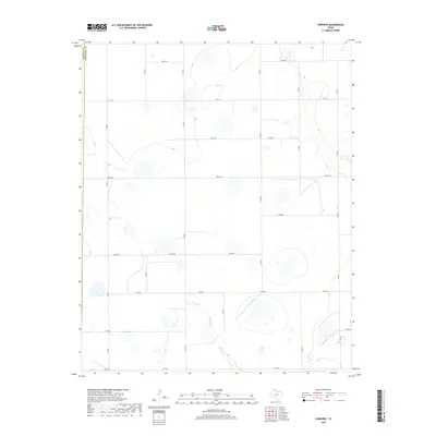
2019 Map of Fairview
USGS Topo · Published 2019About this map
Rush Creek defines the lower drainage of this landscape where the high plains of the Panhandle meet the breaks of the Red River basin. Located along the boundary of Randall and Armstrong Counties, the area is characterized by a precise grid of rural routes and farm-to-market roads that facilitate the region's agricultural economy. Major thoroughfares such as Fm 1151 and Fm 1258 provide the primary east-west connectivity across the quadrangle, while a series of named local roads including Hotel Rd, Golf Rd, and Juliet Rd segment the territory into large, productive tracts. The topography transitions from flat upland plains to the more dissected drainage areas surrounding Rush Cr, illustrating the subtle but important water-carved features of the Texas Panhandle.
Find a feature on this map
20 named features on this map. Tap any name to fly to it.
Don’t see what you’re looking for? This feature index may not catch every label — zoom into the map to look around manually.
Map Details
Editions of this 2019 Fairview Map
This is the sole edition of this map. No revisions or reprints were ever made.
Other maps of this area

1954 · Amarillo
USGS Topo · 1:250,000

1954 · Plainview
USGS Topo · 1:250,000

1956 · Fortress Cliff
USGS Topo · 1:24,000

1956 · Washburn
USGS Topo · 1:24,000

1956 · Thomas Ranch
USGS Topo · 1:24,000

1956 · Pullman
USGS Topo · 1:24,000

1958 · Amarillo
USGS Topo · 1:250,000

1958 · Plainview
USGS Topo · 1:250,000

1960 · Fairview
USGS Topo · 1:24,000

1960 · Claude
USGS Topo · 1:62,500