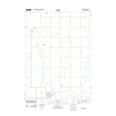
2012 Map of Fairview
USGS Topo · Published 2012About this map
The Big Sioux River carves a winding path along the border of South Dakota and Iowa, defining the western edge of this 2012 survey. At the southern end of the sheet, the town of Hudson serves as a local hub near the confluence of Pattee Cr and the river, while the Rock River joins from the east. The landscape is structured by a strict section-line road grid, including Cherry Ave and Chestnut Ave, connecting remote farmsteads and agricultural operations like the Ysselstein Dairy.
Find a feature on this map
47 named features on this map. Tap any name to fly to it.
Don’t see what you’re looking for? This feature index may not catch every label — zoom into the map to look around manually.
Map Details
Editions of this 2012 Fairview Map
This is the sole edition of this map. No revisions or reprints were ever made.
Other maps of this area

1897 · Canton
USGS Topo · 1:125,000

1900 · Canton
USGS Topo · 1:125,000

1955 · Sioux Falls
USGS Topo · 1:250,000

1958 · Sioux Falls
USGS Topo · 1:250,000

1962 · Canton
USGS Topo · 1:24,000

1968 · Alcester NE
USGS Topo · 1:24,000
1968 · Alcester SE
USGS Topo · 1:24,000
1968 · Hawarden North
USGS Topo · 1:24,000

1968 · Fairview
USGS Topo · 1:24,000

1968 · Labanon
USGS Topo · 1:24,000