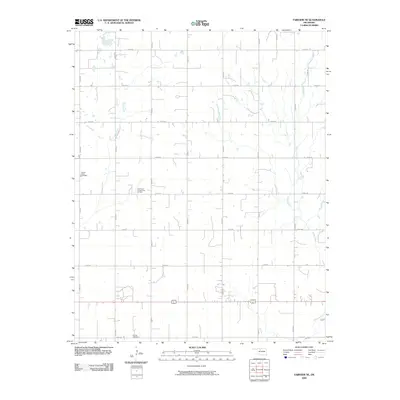
2009 Map of Fairview NE
USGS Topo · Published 2009About this map
Indian Creek meanders through the eastern section of this Major County landscape, where the rural grid of Oklahoma's panhandle-fringe region is defined by an extensive network of section-line roads. The agricultural character of the area is punctuated by specialized land uses, most notably the energy infrastructure found at the Southeast Chaney Dell Oil Field in the west-central portion of the quadrangle. Local heritage and community genealogy are grounded in the presence of two historic burial sites, Square Cedar Cemetery and Forrest Cemetery, which serve as quiet markers of the families who settled this prairie terrain. The map's high-resolution detail documents the persistent grid layout of numbered roads, such as N2600 Rd and E0360 Rd, providing a precise record of the 2009 rural landscape and its developed resource extraction points.
Find a feature on this map
21 named features on this map. Tap any name to fly to it.
Don’t see what you’re looking for? This feature index may not catch every label — zoom into the map to look around manually.
Map Details
Editions of this 2009 Fairview NE Map
This is the sole edition of this map. No revisions or reprints were ever made.
Other maps of this area

1955 · Woodward
USGS Topo · 1:250,000

1956 · Ringwood
USGS Topo · 1:62,500

1958 · Woodward
USGS Topo · 1:250,000

1968 · Carmen
USGS Topo · 1:24,000

1969 · Goltry
USGS Topo · 1:24,000

1969 · Fairview NE
USGS Topo · 1:24,000

1969 · Helena
USGS Topo · 1:24,000

1969 · Fairview SE
USGS Topo · 1:24,000

1969 · Fairview
USGS Topo · 1:24,000

1969 · Cleo Springs
USGS Topo · 1:24,000