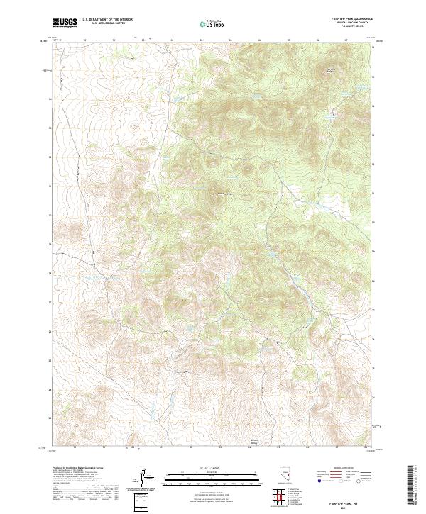
2021 Map of Fairview Peak
USGS Topo · Published 2021About this map
Fairview Peak dominates this high-desert landscape in Lincoln County, where the southern extent of the Fairview Range meets the broad Bristol Valley. This terrain is characterized by its vital water sources, as indicated by a high density of named springs that likely served as essential landmarks for early travelers and livestock. Notable examples include Hornsilver Spring, Indian Spring, and Cactus Spring. Drainage patterns across the quadrangle are defined by several large ephemeral washes, such as Fairview Wash, Scotty Wash, and Bailey Wash. The placement of Fox Cabin Spring and Peers Spring suggests focal points for local movement through the basin-and-range topography. This modern data, compiled by the U.S. Geological Survey, meticulously documents these permanent water features and the complex land survey system that partitions this arid region.
Find a feature on this map
24 named features on this map. Tap any name to fly to it.
Don’t see what you’re looking for? This feature index may not catch every label — zoom into the map to look around manually.
Map Details
Editions of this 2021 Fairview Peak Map
This is the sole edition of this map. No revisions or reprints were ever made.
Other maps of this area

1915 · Bristol Range
USGS Topo · 1:62,500

1917 · Bristol Range
USGS Topo · 1:62,500

1953 · Bristol Range SE
USGS Topo · 1:24,000

1956 · Lund
USGS Topo · 1:250,000

1960 · Lund
USGS Topo · 1:250,000
1971 · Bristol Well
USGS Topo · 1:24,000
1971 · Bristol Range NE
USGS Topo · 1:24,000

1971 · Bailey Wash
USGS Topo · 1:24,000
1971 · Fairview Peak
USGS Topo · 1:24,000

1971 · Sidehill Pass
USGS Topo · 1:24,000