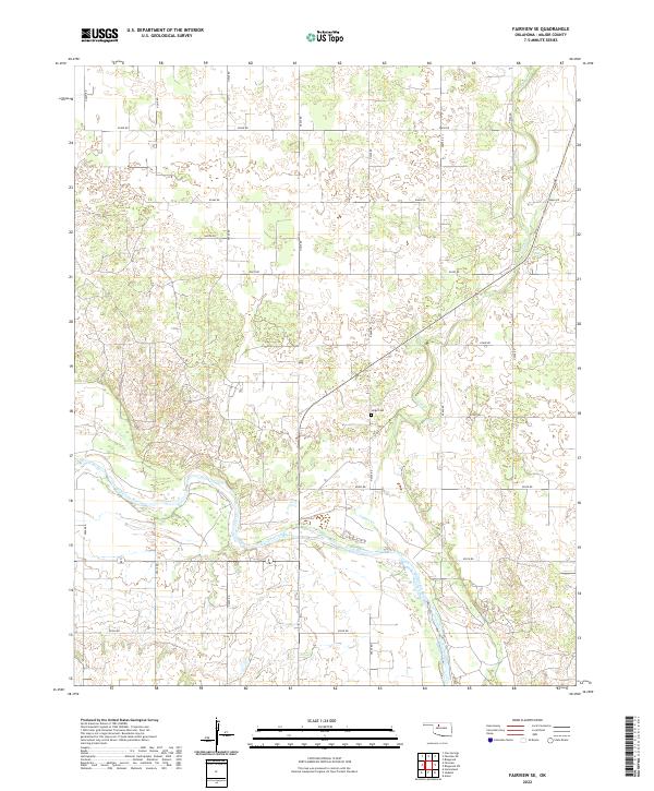
2022 Map of Fairview SE
USGS Topo · Published 2022About this map
The Cimarron River winds through this section of Major County, carving a wide path across the landscape where it meets the drainage of Indian Cr. This survey illustrates a strictly organized grid of rural section lines, including E0450 Rd and E0520 Rd, which define the agricultural character of the region. A notable point of local history is the Sorge Cem, a family-named landmark situated near the banks of Indian Creek. The map details the transition between the river's riparian zones and the surrounding plains, providing a clear record of the area's modern land divisions and environmental features.
Find a feature on this map
16 named features on this map. Tap any name to fly to it.
Don’t see what you’re looking for? This feature index may not catch every label — zoom into the map to look around manually.
Map Details
Editions of this 2022 Fairview SE Map
This is the sole edition of this map. No revisions or reprints were ever made.
Other maps of this area

1893 · Ames
USGS Topo · 1:62,500

1955 · Woodward
USGS Topo · 1:250,000

1956 · Ames
USGS Topo · 1:62,500

1956 · Ringwood
USGS Topo · 1:62,500

1958 · Woodward
USGS Topo · 1:250,000

1969 · Fairview NE
USGS Topo · 1:24,000

1969 · Fairview SE
USGS Topo · 1:24,000

1969 · Fairview
USGS Topo · 1:24,000

1969 · Cleo Springs
USGS Topo · 1:24,000

1972 · Homestead
USGS Topo · 1:24,000