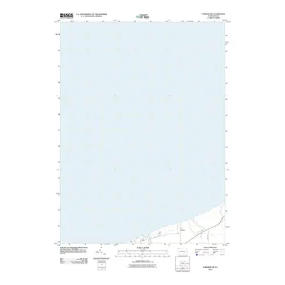
2010 Map of Fairview SW
USGS Topo · Published 2010About this map
The Lake Erie shoreline in Springfield Township is the defining element of this 2010 survey. The map records a landscape heavily dedicated to recreation and youth camps, including the grounds of Camp Fitch, Camp Judson, and Camp Sequoyah. These facilities occupy the coastal bluffs overlooking the lake, separated by the small drainage of Crooked Cr. The local road network is represented by routes such as Abels Rd and Townline Rd, which provide access to the rural properties and seasonal camps that line the lakefront. This edition captures the specific parcel layout and recreational infrastructure of the Pennsylvania coast during the early 21st century.
Find a feature on this map
6 named features on this map. Tap any name to fly to it.
Don’t see what you’re looking for? This feature index may not catch every label — zoom into the map to look around manually.
Map Details
Editions of this 2010 Fairview SW Map
This is the sole edition of this map. No revisions or reprints were ever made.
Other maps of this area

1900 · Girard
USGS Topo · 1:62,500

1900 · Fairview
USGS Topo · 1:62,500

1906 · Conneaut
USGS Topo · 1:62,500

1950 · Cleveland
USGS Topo · 1:250,000

1950 · Erie
USGS Topo · 1:250,000

1956 · Cleveland
USGS Topo · 1:250,000

1957 · Fairview SW
USGS Topo · 1:24,000
1957 · Fairview
USGS Topo · 1:24,000

1959 · East Springfield
USGS Topo · 1:24,000
1959 · Albion
USGS Topo · 1:24,000