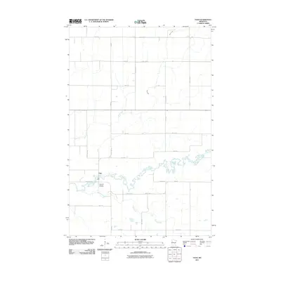
2011 Map of Faith
USGS Topo · Published 2011About this map
Faith is the primary settlement in this section of Norman County, where the Wild Rice River winds through the Red River Valley landscape. The river’s path is marked by the presence of the Faith Dam, a notable local landmark near the village. To the south of the settlement, the Saint Olaf Lutheran Cemetery provides a focal point for genealogical interest, representing the long-standing community roots in this agricultural region. The terrain is defined by the drainage patterns of Marsh Creek and Spring Creek, which move through a strictly gridded network of rural routes such as County Hwy-165 and County Hwy-40. This map captures the persistent character of a Minnesota farming community where transport and water management define the layout of the land.
Find a feature on this map
28 named features on this map. Tap any name to fly to it.
Don’t see what you’re looking for? This feature index may not catch every label — zoom into the map to look around manually.
Map Details
Editions of this 2011 Faith Map
This is the sole edition of this map. No revisions or reprints were ever made.
Other maps of this area

1918 · Flom
USGS Topo · 1:62,500

1952 · Grand Forks
USGS Topo · 1:250,000

1954 · Bemidji
USGS Topo · 1:250,000

1956 · Grand Forks
USGS Topo · 1:250,000

1957 · Bemidji
USGS Topo · 1:250,000

1958 · Bemidji
USGS Topo · 1:250,000

1965 · Waukon
USGS Topo · 1:24,000

1966 · Flom
USGS Topo · 1:24,000

1966 · Grand Forks
USGS Topo · 1:250,000
1966 · Flom NE
USGS Topo · 1:24,000