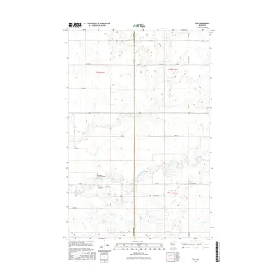
2016 Map of Faith
USGS Topo · Published 2016About this map
Wild Rice River meanders across the landscape of Norman County, defining the drainage patterns of this agricultural region near the community of Faith. The terrain is marked by a complex system of water management, most notably the Judicial Ditch Number Fiftyfive which runs along the border shared with Mahnomen County. This network of natural waterways like Marsh Cr and Spring Cr alongside engineered ditches illustrates the long-standing efforts to master the prairie for cultivation. For those researching local history, the Saint Olaf Lutheran Cem stands as a significant landmark south of the Wild Rice River, situated near the intersection of Co Rd 29 and 460th St, providing a genealogical focal point for the surrounding rural townships.
Find a feature on this map
43 named features on this map. Tap any name to fly to it.
Don’t see what you’re looking for? This feature index may not catch every label — zoom into the map to look around manually.
Map Details
Editions of this 2016 Faith Map
This is the sole edition of this map. No revisions or reprints were ever made.
Other maps of this area

1918 · Flom
USGS Topo · 1:62,500

1952 · Grand Forks
USGS Topo · 1:250,000

1954 · Bemidji
USGS Topo · 1:250,000

1956 · Grand Forks
USGS Topo · 1:250,000

1957 · Bemidji
USGS Topo · 1:250,000

1958 · Bemidji
USGS Topo · 1:250,000

1965 · Waukon
USGS Topo · 1:24,000

1966 · Flom
USGS Topo · 1:24,000

1966 · Grand Forks
USGS Topo · 1:250,000
1966 · Flom NE
USGS Topo · 1:24,000