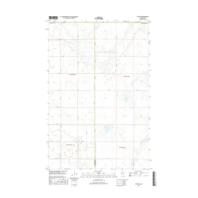
2016 Map of Faith NE
USGS Topo · Published 2016About this map
The Sand Hill River meanders across this rural landscape at the border of Norman and Mahnomen counties. The terrain is defined by its hydrological management, most notably the long straight course of Judicial Ditch Number Fiftyfive which cuts North-South through the center of the survey area. This network of ditches and natural waterways, including Marsh Cr and the waters of Frog Lake, illustrates the intensive drainage efforts common in this part of the Red River Valley to support agriculture. A rigid grid of section-line roads, such as Co Rd 107 and Co Hwy 178, partitions the land into large parcels, reflecting the enduring legacy of the Public Land Survey System in northwestern Minnesota.
Find a feature on this map
30 named features on this map. Tap any name to fly to it.
Don’t see what you’re looking for? This feature index may not catch every label — zoom into the map to look around manually.
Map Details
Editions of this 2016 Faith NE Map
This is the sole edition of this map. No revisions or reprints were ever made.
Other maps of this area

1919 · Valley
USGS Topo · 1:62,500

1952 · Grand Forks
USGS Topo · 1:250,000

1954 · Bemidji
USGS Topo · 1:250,000

1956 · Grand Forks
USGS Topo · 1:250,000

1957 · Bemidji
USGS Topo · 1:250,000

1958 · Bemidji
USGS Topo · 1:250,000

1965 · Waukon
USGS Topo · 1:24,000

1966 · Grand Forks
USGS Topo · 1:250,000
1966 · Halverson Lake
USGS Topo · 1:24,000

1966 · Union Lake
USGS Topo · 1:24,000