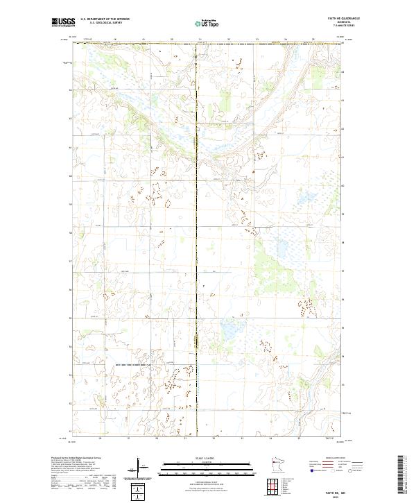
2022 Map of Faith NE
USGS Topo · Published 2022About this map
The Sand Hill River meanders across the northern portion of this landscape, marking the intersection of Polk Co, Mahnomen Co, and Norman Co. This region of northwestern Minnesota is defined by a grid-like network of rural transit and water management, where numerous drainage projects like Judicial Ditch Number Fiftyfive serve to manage the prairie wetlands. The terrain is dotted with small marshes and unnamed water bodies, particularly concentrated in the southeastern sections near Marsh Cr. Local transportation relies on a system of numbered county roads and township avenues, such as Co Hwy 178 and Co Rd 133, which connect the dispersed agricultural plots that dominate the local economy and land use pattern.
Find a feature on this map
27 named features on this map. Tap any name to fly to it.
Don’t see what you’re looking for? This feature index may not catch every label — zoom into the map to look around manually.
Map Details
Editions of this 2022 Faith NE Map
This is the sole edition of this map. No revisions or reprints were ever made.
Other maps of this area

1919 · Valley
USGS Topo · 1:62,500

1952 · Grand Forks
USGS Topo · 1:250,000

1954 · Bemidji
USGS Topo · 1:250,000

1956 · Grand Forks
USGS Topo · 1:250,000

1957 · Bemidji
USGS Topo · 1:250,000

1958 · Bemidji
USGS Topo · 1:250,000

1965 · Waukon
USGS Topo · 1:24,000

1966 · Grand Forks
USGS Topo · 1:250,000
1966 · Halverson Lake
USGS Topo · 1:24,000

1966 · Union Lake
USGS Topo · 1:24,000