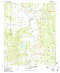
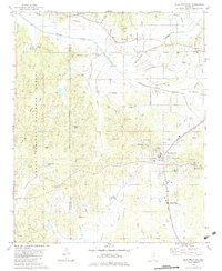
1982 Map of Falkner
USGS Topo · Published 1983About this map
Falkner serves as the central hub of this Tippah County landscape, situated along the Illinois Central Gulf rail line. The terrain transitions from the eastern edge of the Holly Springs National Forest into a network of creek bottoms and low ridges. Local life is anchored by numerous rural congregations and family burial grounds, including Bethlehem Ch, Walnut Creek Ch, and the McCown Cem. To the south, the northern reaches of Ripley appear alongside industrial and recreational markers such as the Campbell Siding and County Lake, which features a Boat Ramp and Campground. The map documents a traditional Mississippi landscape where small-scale industry, evidenced by several Sandpit locations, coexists with established family landmarks like Wicker Mountain and Lindsey Mountain.
Find a feature on this map
51 named features on this map. Tap any name to fly to it.
Don’t see what you’re looking for? This feature index may not catch every label — zoom into the map to look around manually.
Map Details
Editions of this 1982 Falkner Map
This is the sole edition of this map. No revisions or reprints were ever made.
Other maps of this area

1950 · Ashland
USGS Topo · 1:62,500

1951 · Walnut
USGS Topo · 1:62,500

1955 · Ripley
USGS Topo · 1:62,500

1955 · Blue Mountain
USGS Topo · 1:62,500

1956 · Tupelo
USGS Topo · 1:250,000

1958 · Tupelo
USGS Topo · 1:250,000
1982 · Dumas
USGS Topo · 1:24,000
1982 · Chalybeate
USGS Topo · 1:24,000
1982 · Ripley
USGS Topo · 1:24,000
1982 · Blue Mountain
USGS Topo · 1:24,000