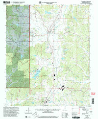
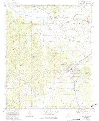
2000 Map of Falkner
USGS Topo · Published 2003About this map
The town of Falkner serves as the focal point for this landscape in northern Tippah County, where the topography transitions from the wooded uplands of the Holly Springs National Forest in the west to the fertile creek bottoms of the east. This 2000 revision documents a deeply established rural community defined by its network of churches and family cemeteries. Significant landmarks include Bethlehem Ch, Walnut Creek Ch, and Pine Hill Ch, alongside numerous burial sites such as McCown Cem and Ruckerville Cem.
Find a feature on this map
46 named features on this map. Tap any name to fly to it.
Don’t see what you’re looking for? This feature index may not catch every label — zoom into the map to look around manually.
Map Details
Editions of this 2000 Falkner Map
This is the sole edition of this map. No revisions or reprints were ever made.
Other maps of this area

1950 · Ashland
USGS Topo · 1:62,500

1951 · Walnut
USGS Topo · 1:62,500

1955 · Ripley
USGS Topo · 1:62,500

1955 · Blue Mountain
USGS Topo · 1:62,500

1956 · Tupelo
USGS Topo · 1:250,000

1958 · Tupelo
USGS Topo · 1:250,000
1982 · Dumas
USGS Topo · 1:24,000
1982 · Chalybeate
USGS Topo · 1:24,000
1982 · Ripley
USGS Topo · 1:24,000
1982 · Blue Mountain
USGS Topo · 1:24,000