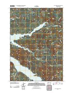
2011 Map of Fall Creek Lake
USGS Topo · Published 2011About this map
Fall Creek Lake dominates the central landscape of this Lane County study, its fingers extending into the drainages of Timber Creek and Station Creek. The settlement of Winberry sits along the southern shore, connected by a network of forest and logging roads such as Peninsula Rd and Big Fall Creek Rd. Further south, the northern reaches of Lookout Point Lake appear, separated from the northern basin by the high divide of Wimble Pass.
Find a feature on this map
37 named features on this map. Tap any name to fly to it.
Don’t see what you’re looking for? This feature index may not catch every label — zoom into the map to look around manually.
Map Details
Editions of this 2011 Fall Creek Lake Map
This is the sole edition of this map. No revisions or reprints were ever made.
Other maps of this area
1935 · Lowell
USGS Topo · 1:96,000
1942 · Lowell
USGS Topo · 1:125,000
1950 · Marcola
USGS Topo · 1:62,500
1951 · Leaburg
USGS Topo · 1:62,500
1952 · Marcola
USGS Topo · 1:62,500

1953 · Salem
USGS Topo · 1:250,000

1954 · Salem
USGS Topo · 1:250,000
1955 · Hardesty Mtn
USGS Topo · 1:62,500
1955 · Lowell
USGS Topo · 1:62,500

1958 · Roseburg
USGS Topo · 1:250,000