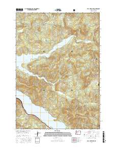
2017 Map of Fall Creek Lake
USGS Topo · Published 2017About this map
Winberry sits as a primary point of settlement within this landscape dominated by the managed timberlands of the Willamette National Forest. The 2017 geography is defined by two major reservoirs: Fall Creek Lake, which collects the drainage of Fall Creek and Winberry Creek, and the northern edge of Lookout Point Lake to the south. This network of waterways is supported by numerous named tributaries such as Nelson Creek, Murphy Creek, and the curiously named Disgust Creek. Numerous peaks and ridges provide a vertical framework for the region, including Fairview Mountain, Greentop, and the elevation at Mt Salem. The extensive road system, including Big Fall Creek Rd and Wineberry Creek Rd, illustrates the intensive infrastructure required for forest management and local access between the mountain passes like Wimble Pass.
Find a feature on this map
47 named features on this map. Tap any name to fly to it.
Don’t see what you’re looking for? This feature index may not catch every label — zoom into the map to look around manually.
Map Details
Editions of this 2017 Fall Creek Lake Map
This is the sole edition of this map. No revisions or reprints were ever made.
Other maps of this area

1935 · Lowell
USGS Topo · 1:96,000

1942 · Lowell
USGS Topo · 1:125,000

1950 · Marcola
USGS Topo · 1:62,500

1951 · Leaburg
USGS Topo · 1:62,500

1952 · Marcola
USGS Topo · 1:62,500

1953 · Salem
USGS Topo · 1:250,000

1954 · Salem
USGS Topo · 1:250,000

1955 · Hardesty Mtn
USGS Topo · 1:62,500

1955 · Lowell
USGS Topo · 1:62,500

1958 · Roseburg
USGS Topo · 1:250,000