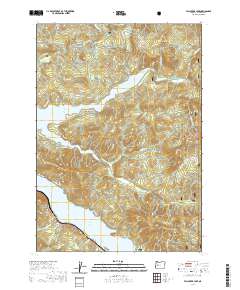
2020 Map of Fall Creek Lake
USGS Topo · Published 2020About this map
Winberry sits as a central point of interest in this 2020 landscape, situated between two significant water bodies: the expansive Fall Creek Lake to the north and the northern reaches of Lookout Point Lake to the south. The terrain is characterized by the densely wooded ridges of the Willamette National Forest, where numerous peaks like Fairview Mtn and Green Butte overlook a complex network of drainage basins.
Find a feature on this map
45 named features on this map. Tap any name to fly to it.
Don’t see what you’re looking for? This feature index may not catch every label — zoom into the map to look around manually.
Map Details
Editions of this 2020 Fall Creek Lake Map
This is the sole edition of this map. No revisions or reprints were ever made.
Other maps of this area

1935 · Lowell
USGS Topo · 1:96,000

1942 · Lowell
USGS Topo · 1:125,000

1950 · Marcola
USGS Topo · 1:62,500

1951 · Leaburg
USGS Topo · 1:62,500

1952 · Marcola
USGS Topo · 1:62,500

1953 · Salem
USGS Topo · 1:250,000

1954 · Salem
USGS Topo · 1:250,000

1955 · Hardesty Mtn
USGS Topo · 1:62,500

1955 · Lowell
USGS Topo · 1:62,500

1958 · Roseburg
USGS Topo · 1:250,000