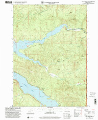
1997 Map of Fall Creek Lake
USGS Topo · Published 2001About this map
Fall Creek Lake and Lookout Point Lake dominate this portion of the Willamette National Forest, revealing a landscape defined by mid-century water management and recreation. The reservoir shorelines are dotted with public access points like Winberry Creek County Park Picnic Area and Landax Landing County Park Picnic Area, illustrating the development of the region for timber and utility purposes.
Find a feature on this map
30 named features on this map. Tap any name to fly to it.
Don’t see what you’re looking for? This feature index may not catch every label — zoom into the map to look around manually.
Map Details
Editions of this 1997 Fall Creek Lake Map
This is the sole edition of this map. No revisions or reprints were ever made.
Other maps of this area

1935 · Lowell
USGS Topo · 1:96,000

1942 · Lowell
USGS Topo · 1:125,000

1950 · Marcola
USGS Topo · 1:62,500

1951 · Leaburg
USGS Topo · 1:62,500

1952 · Marcola
USGS Topo · 1:62,500

1953 · Salem
USGS Topo · 1:250,000

1954 · Salem
USGS Topo · 1:250,000

1955 · Hardesty Mtn
USGS Topo · 1:62,500

1955 · Lowell
USGS Topo · 1:62,500

1958 · Roseburg
USGS Topo · 1:250,000