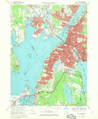
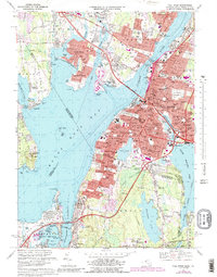
1967 Map of Fall River
USGS Topo · Published 1970About this map
Fall River serves as the industrial and civic anchor of this late-1960s survey, showing a landscape defined by its deep relationship with the Taunton River and Mount Hope Bay. The city’s dense urban fabric is meticulously detailed, from the cluster of educational and religious institutions like Sacred Heart Academy and St Anne Sch to major transportation arteries including the Braga Bridge and the Penn Central rail lines. Across the water, the transition from industrial waterfront to residential and suburban pockets like Ocean Grove and South Swansea is evident, reflecting the post-war expansion of the region.
Find a feature on this map
122 named features on this map. Tap any name to fly to it.
Don’t see what you’re looking for? This feature index may not catch every label — zoom into the map to look around manually.
Map Details
Editions of this 1967 Fall River Map
5 editions found
Other maps of this area

1885 · Taunton
USGS Topo · 1:62,500

1887 · Providence
USGS Topo · 1:62,500

1888 · Fall River
USGS Topo · 1:62,500

1888 · Taunton
USGS Topo · 1:62,500

1889 · Providence
USGS Topo · 1:62,500

1890 · Narragansett Bay
USGS Topo · 1:62,500

1892 · Narragansett Bay
USGS Topo · 1:62,500

1893 · Taunton
USGS Topo · 1:62,500

1893 · Fall River
USGS Topo · 1:62,500

1894 · Providence
USGS Topo · 1:62,500