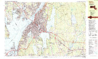
1985 Map of Fall River
USGS Topo · Published 1985About this map
Fall River and its surrounding coastal communities are shown in this mid-1980s survey, illustrating a landscape defined by the convergence of the Taunton River, Mount Hope Bay, and the sprawling waters of North Watuppa Pond and South Watuppa Pond. The city's industrial heritage is evident in the dense development near Globe Village and the Quequechan River, while the waterfront is anchored by the Braga Bridge and the permanent stationing of the USS Massachusetts. To the east, the terrain transitions into the protected woodlands of the Freetown Fall River State Forest and the Copicut Reservoir. Genealogists will find numerous local landmarks, including the Polish National Cem and St Marys Cem, alongside dozens of schools like Durfee High Sch. The map also captures the distinct character of outlying villages such as Westport Factory, Hixville, and Pottersville.
Find a feature on this map
105 named features on this map. Tap any name to fly to it.
Don’t see what you’re looking for? This feature index may not catch every label — zoom into the map to look around manually.
Map Details
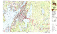
Editions of this 1985 Fall River Map
2 editions found
Other maps of this area

1885 · New Bedford
USGS Topo · 1:62,500

1885 · Middleboro
USGS Topo · 1:62,500

1885 · Taunton
USGS Topo · 1:62,500

1887 · Providence
USGS Topo · 1:62,500

1888 · New Bedford
USGS Topo · 1:62,500

1888 · Fall River
USGS Topo · 1:62,500

1888 · Taunton
USGS Topo · 1:62,500

1888 · Middleboro
USGS Topo · 1:62,500

1889 · Providence
USGS Topo · 1:62,500

1890 · Narragansett Bay
USGS Topo · 1:62,500