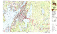
1985 Map of Fall River
USGS Topo · Published 1985About this map
The Fall River waterfront and its industrial corridor dominate this mid-1980s landscape, centered on the Quequechan River as it flows between the massive North Watuppa Pond and South Watuppa Pond toward the coast. The urban core is deeply integrated with its maritime geography, featuring the prominent Braga Bridge spanning the Taunton River and the permanent station of the USS Massachusetts at Battleship Cove. Beyond the dense residential grids of Flint Village and Globe Village, the map documents a period of significant infrastructure development, including the complex interchanges of the Fall River Expressway. To the east, the terrain shifts abruptly to the protected woodlands of the Freetown Fall River State Forest and the Copicut Reservoir, illustrating the sharp boundary between the city's manufacturing legacy and its vital watershed protections. Notable local landmarks like the Borden Flats Lighthouse and Bristol Community College anchor the community's coastal and educational identity.
Find a feature on this map
78 named features on this map. Tap any name to fly to it.
Don’t see what you’re looking for? This feature index may not catch every label — zoom into the map to look around manually.
Map Details
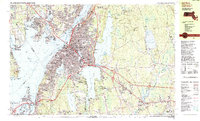
Editions of this 1985 Fall River Map
2 editions found
Other maps of this area

1885 · New Bedford
USGS Topo · 1:62,500

1885 · Middleboro
USGS Topo · 1:62,500

1885 · Taunton
USGS Topo · 1:62,500

1887 · Providence
USGS Topo · 1:62,500

1888 · New Bedford
USGS Topo · 1:62,500

1888 · Fall River
USGS Topo · 1:62,500

1888 · Taunton
USGS Topo · 1:62,500

1888 · Middleboro
USGS Topo · 1:62,500

1889 · Providence
USGS Topo · 1:62,500

1890 · Narragansett Bay
USGS Topo · 1:62,500