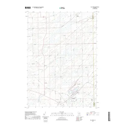
2018 Map of Fall River
USGS Topo · Published 2018About this map
Fall River serves as the primary hub of this landscape, situated near the southern shores of Lazy Lake. The area's water network is defined by the N Br Crawfish River, which feeds into the lake and is supported by tributaries like Beaver Cr and Jennings Cr. Traces of earlier industrial history are evident in the Old Mill Race located near the town center, while the surrounding rural countryside is dotted with established community landmarks.
Find a feature on this map
62 named features on this map. Tap any name to fly to it.
Don’t see what you’re looking for? This feature index may not catch every label — zoom into the map to look around manually.
Map Details
Editions of this 2018 Fall River Map
This is the sole edition of this map. No revisions or reprints were ever made.
Other maps of this area

1955 · Randolph
USGS Topo · 1:62,500

1955 · Columbus
USGS Topo · 1:62,500

1955 · Beaver Dam
USGS Topo · 1:62,500

1955 · Fox Lake
USGS Topo · 1:62,500

1957 · Madison
USGS Topo · 1:250,000

1960 · Madison
USGS Topo · 1:250,000

1980 · Fond Du Lac
USGS Topo · 1:100,000
1980 · North Bristol
USGS Topo · 1:24,000

1980 · Lost Lake
USGS Topo · 1:24,000
1980 · Columbus
USGS Topo · 1:24,000