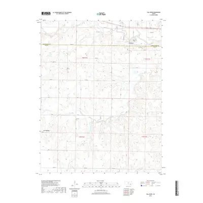
2018 Map of Fall River
USGS Topo · Published 2018About this map
The Fall River community sits at the border of Greenwood and Elk counties, where the waterway of the same name meets a network of local tributaries. This 2018 survey documents a landscape defined by its riparian corridors, including Salt Creek to the north and the complex drainage of Indian Creek and Little Indian Creek to the south. The rural character of the region is evident in the grid of township roads like TWP RD 463 and Settler Rd, which connect scattered homesteads and points of interest. Genealogists and local historians will find significant landmarks such as Mount Zion Cem and Wade Cem, alongside the small settlement of Cave Springs. The map illustrates how modern property boundaries and rural routes like Native Rd and Turkey Rd continue to follow the natural contours and section lines of the Kansas prairie.
Find a feature on this map
37 named features on this map. Tap any name to fly to it.
Don’t see what you’re looking for? This feature index may not catch every label — zoom into the map to look around manually.
Map Details
Editions of this 2018 Fall River Map
This is the sole edition of this map. No revisions or reprints were ever made.
Other maps of this area

1885 · Eureka
USGS Topo · 1:125,000

1885 · Sedan
USGS Topo · 1:125,000

1886 · Fredonia
USGS Topo · 1:125,000

1886 · Independence
USGS Topo · 1:125,000

1888 · Eureka
USGS Topo · 1:125,000

1889 · Sedan
USGS Topo · 1:125,000

1894 · Fredonia
USGS Topo · 1:125,000

1894 · Independence
USGS Topo · 1:125,000

1894 · Eureka
USGS Topo · 1:125,000

1905 · Independence
USGS Topo · 1:125,000