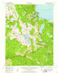
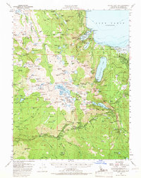
1955 Map of Fallen Leaf Lake
USGS Topo · Published 1961About this map
Lake Tahoe and the high alpine basins of the Crystal Range dominate this mid-century topographic study. The map documents the mid-1950s landscape of the Sierra Nevada, where recreational development and ranching history meet. Landmarks like Vikingholm on Emerald Bay stand alongside organized youth and municipal retreats such as the Berkeley Municipal Camp and Camp Cody (BSA). The transition from the rugged Desolation Valley Wild Area to the settled lakefront is clear, showing established communities like Tallac Village and Tahoe Valley near the marshes.
Find a feature on this map
219 named features on this map. Tap any name to fly to it.
Don’t see what you’re looking for? This feature index may not catch every label — zoom into the map to look around manually.
Map Details
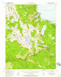
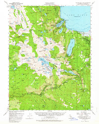
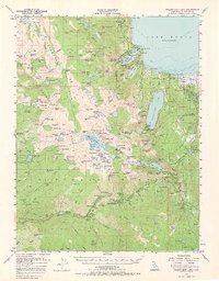
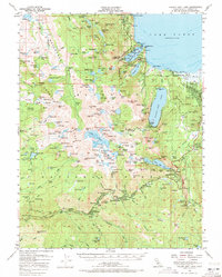
Editions of this 1955 Fallen Leaf Lake Map
7 editions found

Other maps of this area

1889 · Pyramid Peak
USGS Topo · 1:125,000

1889 · Markleeville
USGS Topo · 1:125,000

1891 · Carson
USGS Topo · 1:125,000

1891 · Markleeville
USGS Topo · 1:125,000

1891 · Truckee
USGS Topo · 1:125,000

1891 · Pyramid Peak
USGS Topo · 1:125,000

1893 · Carson
USGS Topo · 1:125,000

1893 · Markleeville
USGS Topo · 1:125,000

1893 · Truckee
USGS Topo · 1:125,000

1895 · Pyramid Peak
USGS Topo · 1:125,000