
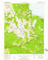
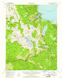
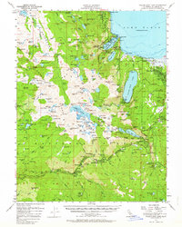
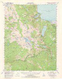
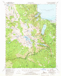
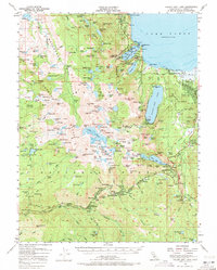
1955 Map of Fallen Leaf Lake
USGS Topo · Published 1977About this map
Lake Tahoe dominates the northeastern corner of this mid-century survey, its shoreline dotted with early resort and municipal developments. Camp Richardson and the burgeoning community of South Lake Tahoe highlight the region's transition into a premier recreation destination. The high Sierra landscape is meticulously documented, from the granite heights of the Crystal Range Trail to the expansive basin of Desolation Valley.
Find a feature on this map
222 named features on this map. Tap any name to fly to it.
Don’t see what you’re looking for? This feature index may not catch every label — zoom into the map to look around manually.
Map Details
Editions of this 1955 Fallen Leaf Lake Map
7 editions found
Other maps of this area

1889 · Pyramid Peak
USGS Topo · 1:125,000

1889 · Markleeville
USGS Topo · 1:125,000

1891 · Carson
USGS Topo · 1:125,000

1891 · Markleeville
USGS Topo · 1:125,000

1891 · Truckee
USGS Topo · 1:125,000

1891 · Pyramid Peak
USGS Topo · 1:125,000

1893 · Carson
USGS Topo · 1:125,000

1893 · Markleeville
USGS Topo · 1:125,000

1893 · Truckee
USGS Topo · 1:125,000

1895 · Pyramid Peak
USGS Topo · 1:125,000