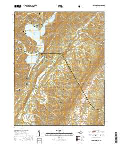
2019 Map of Falling Spring
USGS Topo · Published 2019About this map
Falling Spring Valley dominates this landscape on the border of Bath and Alleghany counties, where the Jackson River carves a deep path through the Allegheny Mountains. The terrain is defined by dramatic ridges such as Bolar Mtn, Coles Mtn, and Warm Springs Mtn, which frame narrow hollows and drafts. Human settlement follows the water and lower gaps, with small communities like Falling Spring, Carloover, and Tinkertown situated along the valley floor. Transportation across the river is facilitated by several named crossings, including McAllister Bridge, Kelly Bridge, and Smith Bridge, linking the scattered homesteads and ridges.
Find a feature on this map
86 named features on this map. Tap any name to fly to it.
Don’t see what you’re looking for? This feature index may not catch every label — zoom into the map to look around manually.
Map Details
Editions of this 2019 Falling Spring Map
This is the sole edition of this map. No revisions or reprints were ever made.
Other maps of this area

1887 · Lewisburg
USGS Topo · 1:125,000

1891 · Lewisburg
USGS Topo · 1:125,000

1891 · Huntersville
USGS Topo · 1:125,000

1894 · Huntersville
USGS Topo · 1:125,000

1894 · Natural Bridge
USGS Topo · 1:125,000

1901 · Monterey
USGS Topo · 1:125,000

1921 · Callaghan
USGS Topo · 1:48,000

1923 · Marlinton
USGS Topo · 1:48,000

1923 · Warm Springs
USGS Topo · 1:48,000

1923 · Callaghan
USGS Topo · 1:62,500