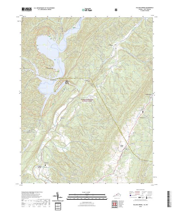
2022 Map of Falling Spring
USGS Topo · Published 2022About this map
Lake Moomaw and the Jackson River define the western landscape of this Virginia and West Virginia borderland, where the water flows through The Gorge and past the elevated Greayers Ridge. The settlement of Falling Spring sits near the river's southern bend, supported by a network of rural churches and burial grounds that anchor the local community history. Notable sites include the Falling Spring Presbyterian Church Cem and the Emory United Methodist Church-Cem, both significant for genealogical research in this corridor. The topography is dominated by parallel mountain structures like Bolar Mtn and Coles Mtn, creating deep valleys such as Falling Spring Valley. This modern survey illustrates the proximity of small hamlets like Valley View, Kincaid, and Tinkertown to the vast expanse of the George Washington National Forest, showing how modern road networks like State Rte 687 navigate the historic gaps and hollows.
Find a feature on this map
83 named features on this map. Tap any name to fly to it.
Don’t see what you’re looking for? This feature index may not catch every label — zoom into the map to look around manually.
Map Details
Editions of this 2022 Falling Spring Map
This is the sole edition of this map. No revisions or reprints were ever made.
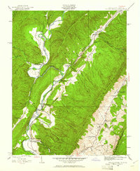
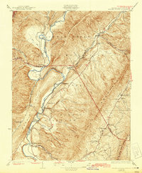
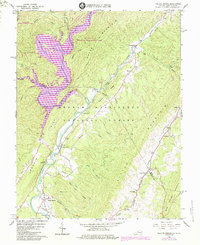
Historical Maps of Valley View Through Time
4 maps found