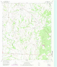
1966 Map of Fallon
USGS Topo · Published 1983About this map
Navasota River bottomlands define the western reaches of this Limestone County landscape, where winding tributaries like Oak Pin Creek and Middle Creek drain toward the river's path. In the mid-1960s, this area remained largely rural, characterized by small communities and rural intersections. The map highlights the legacy of rail transport through the presence of the Southern Pacific line and an Old Railroad Grade passing through Shiloh.
Find a feature on this map
33 named features on this map. Tap any name to fly to it.
Don’t see what you’re looking for? This feature index may not catch every label — zoom into the map to look around manually.
Map Details
Editions of this 1966 Fallon Map
2 editions found
Other maps of this area

1920 · Mexia
USGS Topo · 1:62,500

1954 · Waco
USGS Topo · 1:250,000

1955 · Waco
USGS Topo · 1:250,000

1957 · Groesbeck
USGS Topo · 1:62,500

1960 · Groesbeck
USGS Topo · 1:24,000

1960 · Tehuacana
USGS Topo · 1:24,000

1963 · Teague North
USGS Topo · 1:24,000

1963 · Mexia
USGS Topo · 1:24,000

1966 · Thornton
USGS Topo · 1:24,000
1966 · Teague South
USGS Topo · 1:24,000