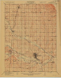
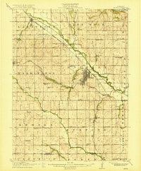
1915 Map of Falls City
USGS Topo · Published 1915About this map
Falls City serves as the dominant rail and municipal hub in this early twentieth-century survey of Richardson County. The landscape is defined by the winding course of the Nemaha River and the extensive network of the Chicago Burlington and Quincy Railroad, which intersects with the Missouri Pacific and Omaha and Kansas City Line. Small agricultural centers such as Shubert, Verdon, and Salem are connected by a dense grid of country roads, while the local economy is punctuated by a Stone Quarry and the County Farm.
Find a feature on this map
59 named features on this map. Tap any name to fly to it.
Don’t see what you’re looking for? This feature index may not catch every label — zoom into the map to look around manually.
Map Details
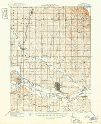
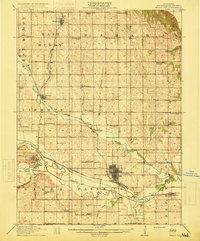
Editions of this 1915 Falls City Map
3 editions found
Other maps of this area

1885 · Atchison
USGS Topo · 1:125,000

1888 · Atchison
USGS Topo · 1:125,000

1888 · Hiawatha
USGS Topo · 1:125,000

1893 · Atchison
USGS Topo · 1:125,000

1894 · Hiawatha
USGS Topo · 1:125,000
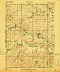
1915 · Falls City
USGS Topo · 1:62,500
1915 · Nemaha
USGS Topo · 1:62,500
1915 · Howe
USGS Topo · 1:62,500
1916 · Humboldt
USGS Topo · 1:62,500

1920 · Craig
USGS Topo · 1:62,500