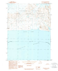
1989 Map of False Pass C-6
USGS Topo · Published 1989About this map
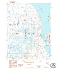
Unimak Island anchors this late-twentieth-century survey, a landscape defined by its coastal position in the Aleutian Islands. The interior is marked by the expansive Aleutian Islands Wilderness, where peaks like Brown Peak 1288T and Conical Red Hill overlook the northern reaches of the Pacific Ocean. On the southern coast, the small settlement of Davis sits near the shore of Unimak Bight, providing a rare point of human activity in this otherwise remote environment. The Lazaref River flows through the eastern portion of the island, cutting through the terrain toward the bight. This document, produced during the late 1980s, delineates the Aleutians East Borough boundary across the open water, offering a clear record of the maritime and terrestrial divisions in this subarctic region.
Find a feature on this map
11 named features on this map. Tap any name to fly to it.
Don’t see what you’re looking for? This feature index may not catch every label — zoom into the map to look around manually.
Map Details
Editions of this 1989 False Pass C-6 Map
This is the sole edition of this map. No revisions or reprints were ever made.
Other maps of this area

1949 · False Pass
USGS Topo · 1:250,000

1950 · False Pass
USGS Topo · 1:250,000

1951 · Unimak
USGS Topo · 1:250,000

1958 · Unimak
USGS Topo · 1:250,000

1989 · Unimak C-1
USGS Topo · 1:63,360
1989 · Unimak D-1
USGS Topo · 1:63,360
1989 · False Pass C-5
USGS Topo · 1:63,360
1989 · False Pass D-6
USGS Topo · 1:63,360
1995 · False Pass D-5
USGS Topo · 1:63,360
2020 · False Pass C-5 SW
USGS Topo · 1:25,000