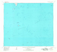
1963 Map of False Pass D-0
USGS Topo · Published 1967About this map
Outer Iliasik Island and a scattering of smaller volcanic outcroppings define this maritime landscape in the Aleutians East during the early 1960s. Surveyed primarily through photogrammetric methods from 1957 aerial photography and field-annotated in 1963, the sheet emphasizes the treacherous hydrography of the Pacific Ocean surrounding these remote landmasses. The map details an intricate network of submerged hazards, most notably the expansive Sandman Reefs and isolated maritime landmarks like Pinnacle Rock and John Rock. These features are vital for understanding the historical navigation routes and maritime safety of the era, as the U.S. Geological Survey incorporated bathymetric data from mid-century Coast and Geodetic Survey charts to illustrate the relationship between the rugged islets like Sarana Island and the shallow shelf of the Bering Sea approaches.
Find a feature on this map
11 named features on this map. Tap any name to fly to it.
Don’t see what you’re looking for? This feature index may not catch every label — zoom into the map to look around manually.
Map Details
Editions of this 1963 False Pass D-0 Map
2 editions found
Other maps of this area

1943 · Fort Randall
USGS Topo · 1:250,000

1949 · False Pass
USGS Topo · 1:250,000

1949 · Fort Randall
USGS Topo · 1:250,000

1950 · False Pass
USGS Topo · 1:250,000

1950 · Fort Randall
USGS Topo · 1:250,000

1953 · Port Moller
USGS Topo · 1:250,000

1963 · Port Moller A-5
USGS Topo · 1:63,360

1963 · Port Moller A-6
USGS Topo · 1:63,360

1963 · False Pass D-1
USGS Topo · 1:63,360
1963 · False Pass C-1
USGS Topo · 1:63,360