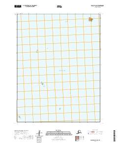
2020 Map of False Pass D-0 SW
USGS Topo · Published 2020About this map
Pacific Ocean waters dominate this remote maritime survey of the Aleutian Islands region. This specific quadrangle reflects the vast expanse of open sea characteristic of the Aleutians East Borough, where the United States Public Land Survey System extends into the ocean as a grid for administrative and navigational reference. The map identifies major township and range lines including t61s r84w and t62s r84w, which delineate jurisdictional boundaries in the north Pacific. While terrestrial features are nearly absent, the map serves as a critical spatial record for maritime navigation and the precise location of underwater terrain within the Aleutian chain.
Find a feature on this map
9 named features on this map. Tap any name to fly to it.
Don’t see what you’re looking for? This feature index may not catch every label — zoom into the map to look around manually.
Map Details
Editions of this 2020 False Pass D-0 SW Map
This is the sole edition of this map. No revisions or reprints were ever made.
Other maps of this area

1949 · False Pass
USGS Topo · 1:250,000

1950 · False Pass
USGS Topo · 1:250,000
1963 · False Pass D-0
USGS Topo · 1:63,360

1963 · False Pass D-1
USGS Topo · 1:63,360
1963 · False Pass C-1
USGS Topo · 1:63,360
2020 · False Pass C-1 NE
USGS Topo · 1:25,000
2020 · False Pass D-1 NE
USGS Topo · 1:25,000
2020 · False Pass D-0 SE
USGS Topo · 1:25,000
2020 · False Pass D-0 NE
USGS Topo · 1:25,000
2020 · False Pass D-0 NW
USGS Topo · 1:25,000