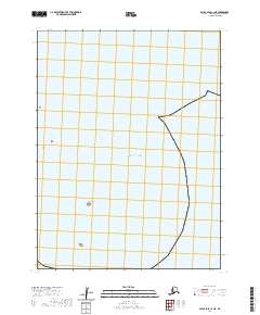
2020 Map of False Pass C-1 NE
USGS Topo · Published 2020About this map
Hay Island and the expansive waters of the Pacific Ocean dominate this coastal survey of the Aleutians East Borough. The map primarily documents the maritime boundary where the open sea meets the island coastline of southwestern Alaska. Derived from data by the U.S. Geological Survey and the Bureau of Land Management, the sheet illustrates the Public Land Survey System grid across four townships, including t63s r86w and t64s r85w. While the area is largely maritime and devoid of industrial or residential development, the inclusion of precise section lines and water body names provides essential geographic context for this remote reach of the Aleutian chain.
Find a feature on this map
6 named features on this map. Tap any name to fly to it.
Don’t see what you’re looking for? This feature index may not catch every label — zoom into the map to look around manually.
Map Details
Editions of this 2020 False Pass C-1 NE Map
This is the sole edition of this map. No revisions or reprints were ever made.
Other maps of this area

1949 · False Pass
USGS Topo · 1:250,000

1950 · False Pass
USGS Topo · 1:250,000
1963 · False Pass D-0
USGS Topo · 1:63,360

1963 · False Pass D-1
USGS Topo · 1:63,360
1963 · False Pass C-1
USGS Topo · 1:63,360
2020 · False Pass C-1 SW
USGS Topo · 1:25,000
2020 · False Pass C-1 SE
USGS Topo · 1:25,000
2020 · False Pass C-1 NW
USGS Topo · 1:25,000
2020 · False Pass D-0 SW
USGS Topo · 1:25,000
2020 · False Pass D-1 SE
USGS Topo · 1:25,000