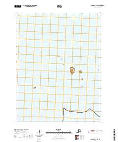
2020 Map of False Pass C-1 NW
USGS Topo · Published 2020About this map
Goose Island and nearby Little Goose Island stand as prominent maritime landmarks in this 2020 survey of the Aleutian waters. The map primarily documents a portion of the Pacific Ocean where underwater navigation hazards like the Sandman Reefs are critical features of the coastal environment. Produced by the U.S. Geological Survey, this sheet illustrates the precise township and range divisions including t63s r87w and t64s r86w over the open sea. While the terrain is largely nautical, the relationship between these small island outcroppings and the surrounding reef systems provides a clear record of the area's maritime geography for researchers and nautical historians.
Find a feature on this map
8 named features on this map. Tap any name to fly to it.
Don’t see what you’re looking for? This feature index may not catch every label — zoom into the map to look around manually.
Map Details
Editions of this 2020 False Pass C-1 NW Map
This is the sole edition of this map. No revisions or reprints were ever made.
Other maps of this area

1949 · False Pass
USGS Topo · 1:250,000

1950 · False Pass
USGS Topo · 1:250,000
1963 · False Pass C-2
USGS Topo · 1:63,360

1963 · False Pass D-1
USGS Topo · 1:63,360

1963 · False Pass D-2
USGS Topo · 1:63,360
1963 · False Pass C-1
USGS Topo · 1:63,360
2020 · False Pass C-1 SW
USGS Topo · 1:25,000
2020 · False Pass C-1 SE
USGS Topo · 1:25,000
2020 · False Pass C-1 NE
USGS Topo · 1:25,000
2020 · False Pass C-2 NE
USGS Topo · 1:25,000