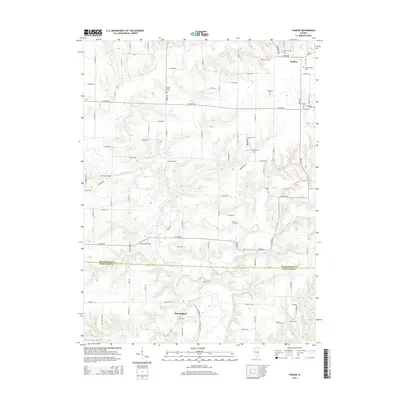
2015 Map of Fandon
USGS Topo · Published 2015About this map
Birmingham sits near the southern edge of this West Central Illinois landscape, where the La Moine River meanders through the border of McDonough and Schuyler counties. The area is defined by its rural grid and a high density of small family and community burial grounds, such as Noel Cem and the isolated Miler Grave in the north. The terrain is deeply incised by watercourses like Troublesome Cr and Camp Cr, which historically dictated road placement and necessitated crossings like the Cow Ford Bridge and Lamoine Bridge. In the north, the small settlement of Fandon serves as a local landmark. The presence of Clark Airport near the center of the map highlights the modern intersection of traditional agriculture and light aviation infrastructure, while numerous rural routes like N 450th Rd connect the scattered farmsteads and historic sites.
Find a feature on this map
48 named features on this map. Tap any name to fly to it.
Don’t see what you’re looking for? This feature index may not catch every label — zoom into the map to look around manually.
Map Details
Editions of this 2015 Fandon Map
This is the sole edition of this map. No revisions or reprints were ever made.
Other maps of this area

1912 · Macomb
USGS Topo · 1:62,500

1913 · Colchester
USGS Topo · 1:62,500

1914 · Macomb
USGS Topo · 1:62,500

1923 · Rushville
USGS Topo · 1:62,500

1926 · Rushville
USGS Topo · 1:62,500

1946 · Augusta
USGS Topo · 1:62,500

1949 · Augusta
USGS Topo · 1:62,500

1958 · Burlington
USGS Topo · 1:250,000

1961 · Burlington
USGS Topo · 1:250,000

1963 · Burlington
USGS Topo · 1:250,000