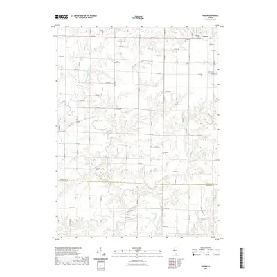
2021 Map of Fandon
USGS Topo · Published 2021About this map
Birmingham sits near the southern edge of this West Central Illinois landscape, where the La Moine River winds through a complex network of tributaries including Camp Creek and Troublesome Cr. The terrain is defined by the sharp transition from high agricultural plateaus to the deeply carved creek bottoms that cross the border between Mcdonough Co and Schuyler Co. A high density of rural burial sites, such as Noel Cem, White Flock Cem, and Gibson Cem, points to a long-established history of family farming and local church communities. Transport across these waterways is facilitated by landmarks like Lamoine Bridge and Cow Ford Bridge, while the presence of Clark Airport indicates the modernization of travel in the rural interior. In the northeast, the small settlement of Fandon serves as a secondary focal point for the surrounding township roads, which follow a strict sectional grid except where diverted by the natural course of Grindstone Cr and Flour Cr.
Find a feature on this map
84 named features on this map. Tap any name to fly to it.
Don’t see what you’re looking for? This feature index may not catch every label — zoom into the map to look around manually.
Map Details
Editions of this 2021 Fandon Map
This is the sole edition of this map. No revisions or reprints were ever made.
Other maps of this area

1912 · Macomb
USGS Topo · 1:62,500

1913 · Colchester
USGS Topo · 1:62,500

1914 · Macomb
USGS Topo · 1:62,500

1923 · Rushville
USGS Topo · 1:62,500

1926 · Rushville
USGS Topo · 1:62,500

1946 · Augusta
USGS Topo · 1:62,500

1949 · Augusta
USGS Topo · 1:62,500

1958 · Burlington
USGS Topo · 1:250,000

1961 · Burlington
USGS Topo · 1:250,000

1963 · Burlington
USGS Topo · 1:250,000