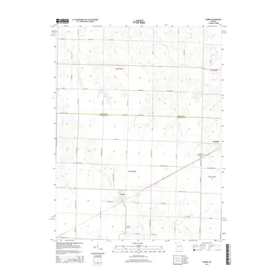
2015 Map of Farber
USGS Topo · Published 2015About this map
Vandalia and Farber anchor this central Missouri landscape, where the agricultural grid is interrupted by a complex network of creeks and small impoundments. The terrain is defined by the drainage systems of Spencer Creek and Bear Br to the north, while the southern portion features the headwaters of E Lick Cr and Hickory Cr. The map captures a transition in land use, showing established town sites alongside modern water management features like Auwarter Lake, Eisele Lake, and Alton Lake. Genealogists will find the exact locations of Farber Cemetery and Evergreen Memorial Gardens Cemetery on the outskirts of the primary settlements. The survey also preserves the precise boundary between Ralls and Audrain counties, showing how local roads like Audrain Rd and Oklahoma Ln navigate the township and range system.
Find a feature on this map
54 named features on this map. Tap any name to fly to it.
Don’t see what you’re looking for? This feature index may not catch every label — zoom into the map to look around manually.
Map Details
Editions of this 2015 Farber Map
This is the sole edition of this map. No revisions or reprints were ever made.
Other maps of this area

1890 · Louisiana
USGS Topo · 1:125,000

1890 · Mexico
USGS Topo · 1:125,000

1942 · Wellsville
USGS Topo · 1:62,500

1942 · Bellflower
USGS Topo · 1:62,500

1943 · Vandalia
USGS Topo · 1:62,500

1945 · Bellflower
USGS Topo · 1:62,500

1945 · Perry
USGS Topo · 1:62,500

1945 · Vandalia
USGS Topo · 1:62,500

1948 · Quincy
USGS Topo · 1:250,000

1956 · Quincy
USGS Topo · 1:250,000