
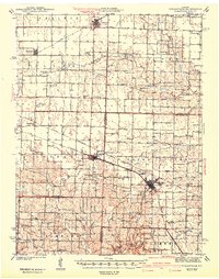
1942 Map of Wellsville
USGS Topo · Published 1942About this map
Wellsville and Martinsburg serve as the primary hubs in this late 1930s landscape, where the confluence of three major railroads—the Alton, the Wabash, and the Chicago Burlington and Quincy—drives the local economy. The transition from the flat agricultural lands of Prairie township in the north to the dissected creek valleys of the Loutre and Shamrock regions in the south is clearly defined. An industrial presence is noted south of Wellsville at the Laclede Christy Mine, suggesting the importance of fire clay or mineral extraction alongside traditional farming.
Find a feature on this map
76 named features on this map. Tap any name to fly to it.
Don’t see what you’re looking for? This feature index may not catch every label — zoom into the map to look around manually.
Map Details
Editions of this 1942 Wellsville Map
2 editions found
Other maps of this area

1890 · Louisiana
USGS Topo · 1:125,000

1890 · Mexico
USGS Topo · 1:125,000

1890 · Hermann
USGS Topo · 1:125,000

1890 · Fulton
USGS Topo · 1:125,000

1928 · Fulton
USGS Topo · 1:62,500

1931 · Fulton
USGS Topo · 1:62,500

1932 · Mexico
USGS Topo · 1:62,500

1940 · Montgomery City
USGS Topo · 1:62,500

1942 · Montgomery City
USGS Topo · 1:62,500

1942 · New Florence
USGS Topo · 1:62,500