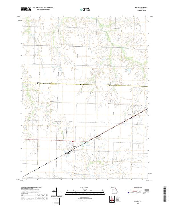
2021 Map of Farber
USGS Topo · Published 2021About this map
Farber and the southwestern edge of Vandalia anchor this 2021 study of the northeastern Missouri landscape. The terrain is defined by a dense network of county roads and state highways that carve through the agricultural interior of Audrain Co and Ralls Co. Significant water features include Spencer Creek, which drains the northeastern corner, and E Lick Cr cutting through the western sections. The map reveals the local infrastructure of the modern era, from the residential layouts of Farber and its municipal Alton Lake to the quiet presence of the Farber Cem and Evergreen Memorial Gardens Cem. The landscape is a mix of small lakes like Auwater Lake and Eisele Lake alongside a naming convention for rural routes that reflects a broad geographic reach, including Wisconsin Ln, California Rd, and Oklahoma Ln.
Find a feature on this map
51 named features on this map. Tap any name to fly to it.
Don’t see what you’re looking for? This feature index may not catch every label — zoom into the map to look around manually.
Map Details
Editions of this 2021 Farber Map
This is the sole edition of this map. No revisions or reprints were ever made.
Other maps of this area

1890 · Louisiana
USGS Topo · 1:125,000

1890 · Mexico
USGS Topo · 1:125,000

1942 · Wellsville
USGS Topo · 1:62,500

1942 · Bellflower
USGS Topo · 1:62,500

1943 · Vandalia
USGS Topo · 1:62,500

1945 · Bellflower
USGS Topo · 1:62,500

1945 · Perry
USGS Topo · 1:62,500

1945 · Vandalia
USGS Topo · 1:62,500

1948 · Quincy
USGS Topo · 1:250,000

1956 · Quincy
USGS Topo · 1:250,000