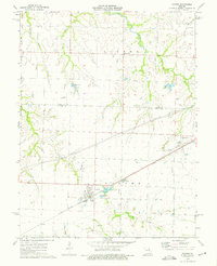
1973 Map of Farber
USGS Topo · Published 1975About this map
Farber and Vandalia anchor this eastern Missouri landscape, situated where the Illinois Central Gulf railroad cuts a diagonal line across the Audrain and Ralls county boundary. The rail line serves as the primary corridor for local industry and transport, passing directly through the heart of both settlements. The area is characterized by its agricultural layout, punctuated by small reservoirs like Alton Lake and Eisele Lake, and specialized rural infrastructure including the Bishop Landing Strip and a Drive-in Theater on the outskirts of Vandalia.
Find a feature on this map
29 named features on this map. Tap any name to fly to it.
Don’t see what you’re looking for? This feature index may not catch every label — zoom into the map to look around manually.
Map Details
Editions of this 1973 Farber Map
This is the sole edition of this map. No revisions or reprints were ever made.
Other maps of this area

1890 · Louisiana
USGS Topo · 1:125,000

1890 · Mexico
USGS Topo · 1:125,000

1942 · Wellsville
USGS Topo · 1:62,500

1942 · Bellflower
USGS Topo · 1:62,500

1943 · Vandalia
USGS Topo · 1:62,500

1945 · Bellflower
USGS Topo · 1:62,500

1945 · Perry
USGS Topo · 1:62,500

1945 · Vandalia
USGS Topo · 1:62,500

1948 · Quincy
USGS Topo · 1:250,000

1956 · Quincy
USGS Topo · 1:250,000