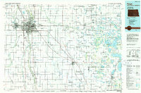
1985 Map of Fargo
USGS Topo · Published 1985About this map
The Red River of the North defines the border between North Dakota and Minnesota, separating the growing urban centers of Fargo and Moorhead during the mid-1980s. This survey illustrates a regional landscape shaped by the Burlington Northern railroad lines that radiate from the city cores toward outlying agricultural settlements like Glyndon, Hawley, and Barnesville. To the east, the flat plains of the Red River Valley transition into a dense concentration of glacial water bodies, including Big Cormorant Lake and Lake Lida, which surround the community of Pelican Rapids. Conservation efforts are visible through the designation of the Bluestem Prairie State Natural Area and Buffalo River State Park, preserving remnants of the native grassland. The map also documents the presence of numerous small townships and rural junctions such as St Benedict and Rustad, offering a detailed view of the regional infrastructure and land use just before the rapid suburban expansion of the late 20th century.
Find a feature on this map
482 named features on this map. Tap any name to fly to it.
Don’t see what you’re looking for? This feature index may not catch every label — zoom into the map to look around manually.
Map Details
Editions of this 1985 Fargo Map
2 editions found
Other maps of this area

1895 · Fargo
USGS Topo · 1:125,000

1895 · Casselton
USGS Topo · 1:125,000

1897 · Fargo
USGS Topo · 1:125,000

1897 · Casselton
USGS Topo · 1:125,000

1904 · Wahpeton
USGS Topo · 1:125,000

1907 · Wyndmere
USGS Topo · 1:125,000

1912 · Vergas
USGS Topo · 1:62,500

1913 · Fergus Falls
USGS Topo · 1:62,500

1914 · Pelican Rapids
USGS Topo · 1:62,500

1915 · Underwood
USGS Topo · 1:62,500