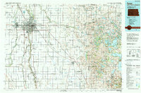
1985 Map of Fargo
USGS Topo · Published 1989About this map
Fargo and Moorhead anchor this 1980s landscape where the Red River Valley meets the lake country of western Minnesota. The urban development around North Dakota State Univ and Hector Field transitions into a grid of agricultural townships like Morken and Kragnes. The map reveals the intricate hydrologic network of the Red River of the North, fed by the Sheyenne River and Buffalo River.
Find a feature on this map
204 named features on this map. Tap any name to fly to it.
Don’t see what you’re looking for? This feature index may not catch every label — zoom into the map to look around manually.
Map Details
Editions of this 1985 Fargo Map
2 editions found
Other maps of this area

1895 · Fargo
USGS Topo · 1:125,000

1895 · Casselton
USGS Topo · 1:125,000

1897 · Fargo
USGS Topo · 1:125,000

1897 · Casselton
USGS Topo · 1:125,000

1904 · Wahpeton
USGS Topo · 1:125,000

1907 · Wyndmere
USGS Topo · 1:125,000

1912 · Vergas
USGS Topo · 1:62,500

1913 · Fergus Falls
USGS Topo · 1:62,500

1914 · Pelican Rapids
USGS Topo · 1:62,500

1915 · Underwood
USGS Topo · 1:62,500