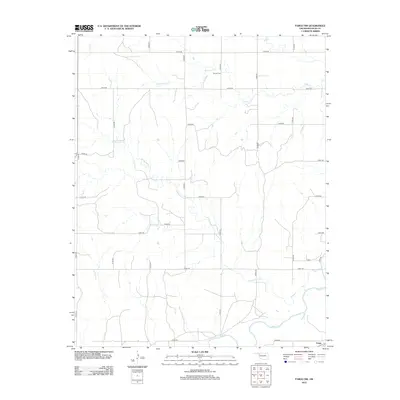
2012 Map of Fargo NW
USGS Topo · Published 2012About this map
The northwest reaches of Fargo anchor this Ellis County landscape, where the high plains terrain is defined by a dendritic network of seasonal and perennial watercourses. Wolf Creek meanders across the southern portion of the sheet, joined from the north by the long, winding path of Sixteenmile Creek. This drainage pattern, which also includes Eightmile Creek and Sand Creek, historically dictated the placement of agricultural boundaries and transport routes in western Oklahoma. The map shows a strictly organized grid of county roads, such as N1870 Road and E0370 Road, which segment the cattle and wheat country. In the northern section, Sunset Cemetery stands as a focal point for local genealogy, situated near the headwaters of Eightmile Creek. The layout of the section lines and the proximity to Fargo illustrate the transition from open range to the modern surveyed ranching parcels of the early 21st century.
Find a feature on this map
25 named features on this map. Tap any name to fly to it.
Don’t see what you’re looking for? This feature index may not catch every label — zoom into the map to look around manually.
Map Details
Editions of this 2012 Fargo NW Map
This is the sole edition of this map. No revisions or reprints were ever made.
Other maps of this area

1955 · Woodward
USGS Topo · 1:250,000

1958 · Woodward
USGS Topo · 1:250,000

1969 · Fargo SW
USGS Topo · 1:24,000

1969 · Fargo
USGS Topo · 1:24,000

1969 · Fargo NW
USGS Topo · 1:24,000

1969 · Gage
USGS Topo · 1:24,000

1969 · Fargo SE
USGS Topo · 1:24,000

1969 · Shattuck NE
USGS Topo · 1:24,000

1971 · May East
USGS Topo · 1:24,000

1971 · Fort Supply
USGS Topo · 1:24,000