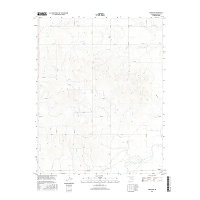
2016 Map of Fargo NW
USGS Topo · Published 2016About this map
Wolf Creek winds through the southern reaches of this landscape in Ellis County, anchoring a terrain defined by a network of seasonal watercourses and rural section roads. The small settlement of Fargo is positioned at the southeastern edge of the survey, serving as a focal point for the surrounding ranching and agricultural lands. North of the creek, the drainage system includes Sixteenmile Cr and Eightmile Cr, which carve subtle valleys across the plains. For local historians and genealogists, the Sunset Cem located along NS 187 Rd provides a specific point of interest for family research. The grid of county roads, including EW 36 Rd and E0440 Rd, reveals the enduring spatial organization of this part of Oklahoma, while labels like Lease Rd suggest the ongoing intersection of land use and local industry.
Find a feature on this map
30 named features on this map. Tap any name to fly to it.
Don’t see what you’re looking for? This feature index may not catch every label — zoom into the map to look around manually.
Map Details
Editions of this 2016 Fargo NW Map
This is the sole edition of this map. No revisions or reprints were ever made.
Other maps of this area

1955 · Woodward
USGS Topo · 1:250,000

1958 · Woodward
USGS Topo · 1:250,000

1969 · Fargo SW
USGS Topo · 1:24,000

1969 · Fargo
USGS Topo · 1:24,000

1969 · Fargo NW
USGS Topo · 1:24,000

1969 · Gage
USGS Topo · 1:24,000

1969 · Fargo SE
USGS Topo · 1:24,000

1969 · Shattuck NE
USGS Topo · 1:24,000

1971 · May East
USGS Topo · 1:24,000

1971 · Fort Supply
USGS Topo · 1:24,000