
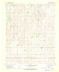
1969 Map of Fargo SE
USGS Topo · Published 1971About this map
Fargo sits at the northwestern edge of this 1969 topographic survey, marking a pocket of settlement near the Fargo Cem along the border of Ellis and Woodward counties. The landscape transitions into the open plains of western Oklahoma, defined by the winding paths of Boggy Creek and Turkey Creek. In the southern portion of the quadrangle, the community of Keenan is situated near the natural drainages that carve through the local topography.
Find a feature on this map
12 named features on this map. Tap any name to fly to it.
Don’t see what you’re looking for? This feature index may not catch every label — zoom into the map to look around manually.
Map Details
Editions of this 1969 Fargo SE Map
This is the sole edition of this map. No revisions or reprints were ever made.
Other maps of this area

1955 · Woodward
USGS Topo · 1:250,000

1958 · Woodward
USGS Topo · 1:250,000

1969 · Fargo SW
USGS Topo · 1:24,000

1969 · Fargo
USGS Topo · 1:24,000

1969 · Fargo NW
USGS Topo · 1:24,000

1969 · Vici NW
USGS Topo · 1:24,000

1969 · Woodward SW
USGS Topo · 1:24,000

1969 · Woodward
USGS Topo · 1:24,000

1970 · Harmon
USGS Topo · 1:24,000
1970 · Harmon NW
USGS Topo · 1:24,000