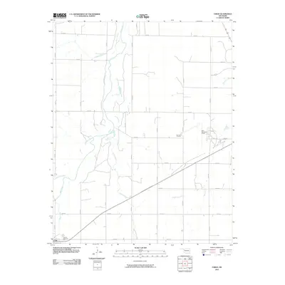
2010 Map of Fargo
USGS Topo · Published 2010About this map
Fargo sits at the southwestern edge of this Ellis County landscape, where the town’s civic footprint is anchored by Braunch Memorial Park. The terrain is defined by a dense network of watercourses, with the winding Wolf Creek cutting a significant path through the center, joined by tributaries like Eightmile Creek and Turkey Creek. This drainage pattern suggests a landscape shaped by persistent erosion and intermittent flow, characteristic of the Oklahoma plains.
Find a feature on this map
30 named features on this map. Tap any name to fly to it.
Don’t see what you’re looking for? This feature index may not catch every label — zoom into the map to look around manually.
Map Details
Editions of this 2010 Fargo Map
This is the sole edition of this map. No revisions or reprints were ever made.
Other maps of this area

1955 · Woodward
USGS Topo · 1:250,000

1958 · Woodward
USGS Topo · 1:250,000

1969 · Fargo SW
USGS Topo · 1:24,000

1969 · Fargo
USGS Topo · 1:24,000

1969 · Fargo NW
USGS Topo · 1:24,000

1969 · Woodward SW
USGS Topo · 1:24,000

1969 · Woodward
USGS Topo · 1:24,000

1969 · Fargo SE
USGS Topo · 1:24,000

1970 · Sleeping Bear Creek SW
USGS Topo · 1:24,000

1971 · May East
USGS Topo · 1:24,000