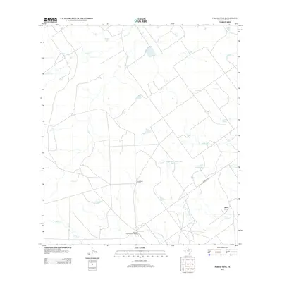
2013 Map of Farias Tank
USGS Topo · Published 2013About this map
The expansive Briscoe Ranch holdings dominate this landscape in Dimmit County, reflecting the deep-rooted ranching heritage of South Texas in the early 21st century. The map centers on the infrastructure required to manage these large-scale operations, including the Briscoes Catarina Ranch Airport and various residential headquarters like Briscoe Ranch Number 2. A network of seasonal drainages and local tanks, such as El Moro Cr, San Roque Cr, and Catarina Cr, crisscross the dry terrain, providing vital water resources for cattle. Near the eastern boundary, Ranch Road 2688 provides the primary transit artery, passing through the settlement area of Gilson Groves. The presence of Dolph Briscoe Lake Number 1 and its counterpart lake further illustrate the significant private water management systems typical of this brush country region.
Find a feature on this map
12 named features on this map. Tap any name to fly to it.
Don’t see what you’re looking for? This feature index may not catch every label — zoom into the map to look around manually.
Map Details
Editions of this 2013 Farias Tank Map
This is the sole edition of this map. No revisions or reprints were ever made.
Other maps of this area

1929 · Cotulla
USGS Topo · 1:125,000

1932 · Valley Wells
USGS Topo · 1:62,500

1940 · Asherton
USGS Topo · 1:62,500

1940 · Velenzuela Creek
USGS Topo · 1:62,500

1940 · San Loranzo Creek
USGS Topo · 1:62,500

1940 · Catarina
USGS Topo · 1:62,500

1953 · Crystal City
USGS Topo · 1:250,000

1955 · Crystal City
USGS Topo · 1:250,000

1961 · Crystal City
USGS Topo · 1:250,000

1968 · Crystal City
USGS Topo · 1:250,000