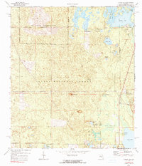
1972 Map of Farles Lake
USGS Topo · Published 1991About this map
The Ocala National Forest defines this central Florida landscape, dominated by a network of prairies, ponds, and sinks. The northern portion of the map is largely occupied by the US Naval Reservation, featuring a prominent Lookout Tower and several claypits. The hydrology of the area is exceptionally detailed, showing the varied character of Farles Lake, Sellers Lake, and the expansive Farles Prairie.
Find a feature on this map
35 named features on this map. Tap any name to fly to it.
Don’t see what you’re looking for? This feature index may not catch every label — zoom into the map to look around manually.
Map Details
Editions of this 1972 Farles Lake Map
2 editions found
Other maps of this area

1954 · Daytona Beach
USGS Topo · 1:250,000

1955 · Orlando
USGS Topo · 1:250,000

1957 · Orlando
USGS Topo · 1:250,000

1958 · Orlando
USGS Topo · 1:250,000

1958 · Daytona Beach
USGS Topo · 1:250,000

1962 · Orlando
USGS Topo · 1:250,000

1964 · Daytona Beach
USGS Topo · 1:250,000

1965 · Umatilla
USGS Topo · 1:24,000
1965 · Paisley
USGS Topo · 1:24,000
1966 · Emeralda Island
USGS Topo · 1:24,000