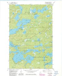
1981 Map of Farm Lake
USGS Topo · Published 1986About this map
Newton Falls marks a point of transition between the interconnected waters of the Superior National Forest in this 1980s revision. The landscape is defined by the labyrinthine waterways of the Boundary Waters Canoe Area Wilderness, where large bodies like Fall Lake and Farm Lake are separated by the massive Bear Island. This era of the map shows a balance between protected wilderness and local infrastructure, such as the Sewage Disposal Ponds near the Fall Lake Campground and the network of Gravel Pits along Fernberg Road. Smaller, descriptively named features like Pea Soup Lake, Sourdough Lake, and Mukluk Bay reflect the local character and nomenclature of the Northwoods. The presence of numerous portages and boat ramps underscores the importance of water travel across the Kawishiwi River system during this period.
Find a feature on this map
43 named features on this map. Tap any name to fly to it.
Don’t see what you’re looking for? This feature index may not catch every label — zoom into the map to look around manually.
Map Details
Editions of this 1981 Farm Lake Map
2 editions found
Other maps of this area

1933 · Ely
USGS Topo · 1:62,500

1939 · Ely
USGS Topo · 1:62,500

1954 · Two Harbors
USGS Topo · 1:250,000

1957 · Two Harbors
USGS Topo · 1:250,000

1957 · Gabbro Lake
USGS Topo · 1:62,500

1957 · Basswood Lake
USGS Topo · 1:62,500

1957 · Quetico
USGS Topo · 1:250,000

1958 · Two Harbors
USGS Topo · 1:250,000

1963 · Fourtown Lake
USGS Topo · 1:24,000

1964 · Two Harbors
USGS Topo · 1:250,000