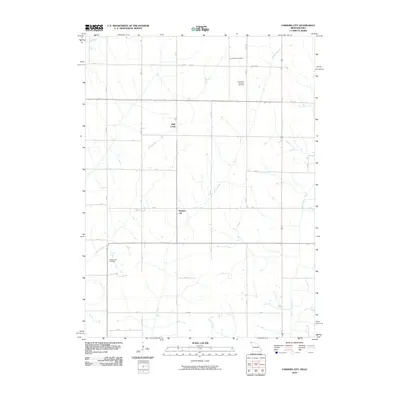
2010 Map of Farmers City
USGS Topo · Published 2010About this map
Farmers City and the small settlement of High Creek anchor this rural landscape in Atchison County, Missouri, at the dawn of the 21st century. The map reveals an area defined by its agricultural grid and the natural drainage of the West Tarkio Creek and Rock Creek systems. For those studying local heritage, the placement of the Locust Grove Cemetery, Saint Pauls Lutheran Cemetery, and Grange Hall Cemetery provides critical geographic markers for early family history in this corner of northwest Missouri. The intricate network of local roads, ranging from numbered streets like 300 St to lettered avenues such as M Ave, illustrates the persistence of the section-line layout that has organized Missouri's farmland for generations.
Find a feature on this map
32 named features on this map. Tap any name to fly to it.
Don’t see what you’re looking for? This feature index may not catch every label — zoom into the map to look around manually.
Map Details
Editions of this 2010 Farmers City Map
This is the sole edition of this map. No revisions or reprints were ever made.
Other maps of this area

1915 · Nemaha
USGS Topo · 1:62,500

1939 · Tarkio
USGS Topo · 1:62,500

1939 · Farragut
USGS Topo · 1:62,500

1939 · Hamburg
USGS Topo · 1:62,500

1939 · Nemaha
USGS Topo · 1:62,500

1940 · Tarkio
USGS Topo · 1:62,500

1940 · Farragut
USGS Topo · 1:62,500

1941 · Tarkio
USGS Topo · 1:62,500

1941 · Hamburg
USGS Topo · 1:62,500

1949 · Nemaha
USGS Topo · 1:62,500