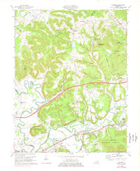
1970 Map of Farmers
USGS Topo · Published 1978About this map
The Licking River winds through this 1970s landscape, defining the border between Rowan and Bath counties as it flows past the concentrated settlements of Farmers and Midland. The corridor is dominated by the Chesapeake and Ohio railroad and US Highway 60, which cut through the river valley near landmarks like Spring Grove Lakes and the Moorehead-Rowan Co Airport. To the north, the terrain transitions into the dense hills of the Daniel Boone National Forest, where smaller communities like Sharkey and Hilda sit at the junctions of creek hollows. Genealogical markers are plentiful, including the Ramey School, Poplar Spring Ch, and numerous family burial grounds such as Eldridge Cem and Jones Cem. From the winding curves of Ingram Bend to the elevations of Sugarloaf Mountain, the map documents a region where river-valley industry and rural homesteads meet the edge of protected federal forest lands.
Find a feature on this map
84 named features on this map. Tap any name to fly to it.
Don’t see what you’re looking for? This feature index may not catch every label — zoom into the map to look around manually.
Map Details
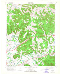
Editions of this 1970 Farmers Map
2 editions found
Other maps of this area

1929 · Morehead
USGS Topo · 1:48,000

1929 · Salt Lick
USGS Topo · 1:62,500

1934 · Salt Lick
USGS Topo · 1:62,500

1935 · Morehead
USGS Topo · 1:62,500

1951 · Cranston
USGS Topo · 1:24,000

1951 · Hillsboro
USGS Topo · 1:24,000

1951 · Plummers Landing
USGS Topo · 1:24,000

1953 · Olympia
USGS Topo · 1:24,000

1953 · Farmers
USGS Topo · 1:24,000

1953 · Bangor
USGS Topo · 1:24,000